Orthomosaics

Check out some of the many possibilities that come from orthomosaics.

An orthomosaic is made up of many smaller, individual photos called ortho photos. These are shot with a camera pointing straight down. Another way to think of these are what you see in Maps or on Google Earth applications, but with much higher resolution and detail.  Creating a current, up-to-date aerial photo, or orthomosaic, is one of the services we offer. We utilize aerial images in almost every aspect of our daily business, so we know what to look for and how to create the best ortho for your needs.

Creating an Orthomosaic

Using the drone, we capture lots of individual photos and then use “stiching” software to tie them all together to create the final orthomosaic. The blue dots show where each individual photo was taken and the orange lines show the travel path of the drone during the survey.

Before and After

This is one of the individual photos taken during the survey. The camera is pointed straight down. Look at the trees near the edge of the photo. Notice how they all seem to “lean” away from the center?

This is a screenshot of the finished orthomosaic after processing. Notice how all the trees are show straight up and down. Also, the photo has been oriented for North being the top of the image. While this was a fairly small project, it still took over 500 individual images to create the new orthomosaic.

Orthomosaic

The following 4 screenshots show the same property, at the same scale, but with orthomosaics captured at 4 different times during the year. Each shows something a bit different and each has it good and bad points. 

This first one was taken in mid April. The white areas are remaining snow drifts that have not melted yet.

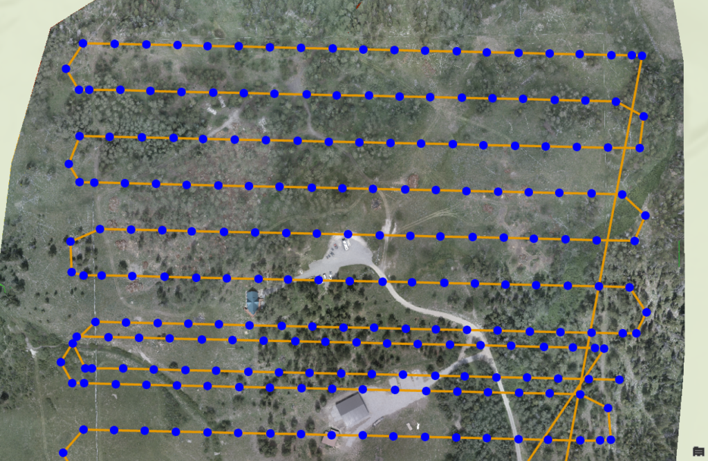
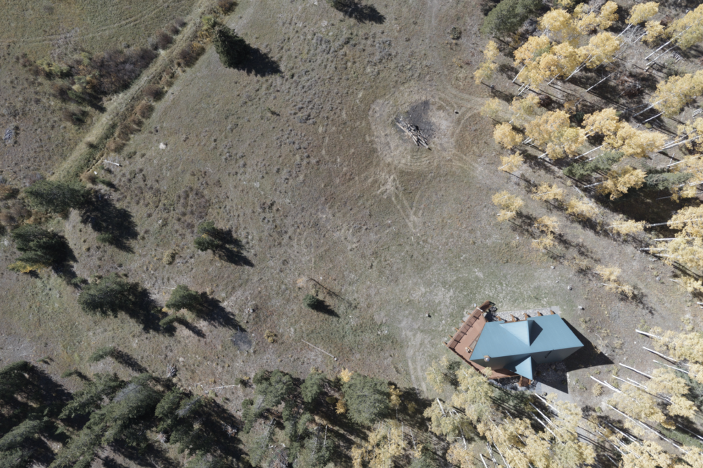
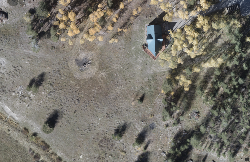
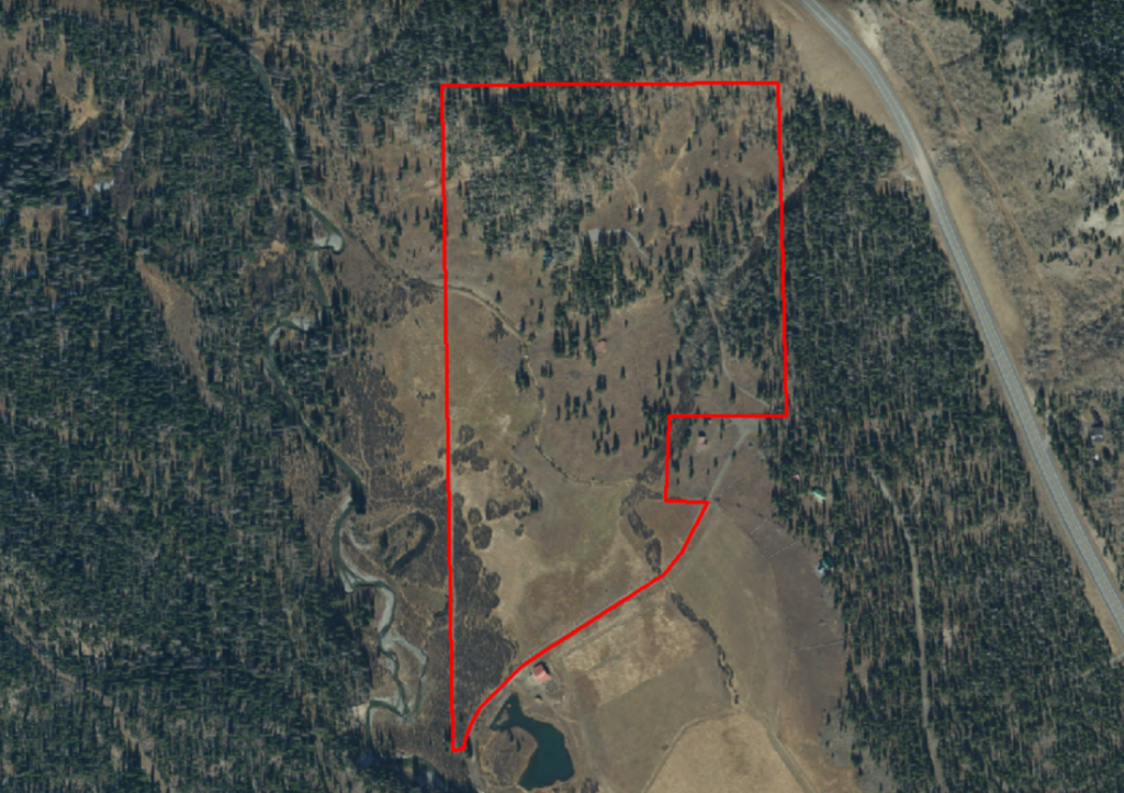
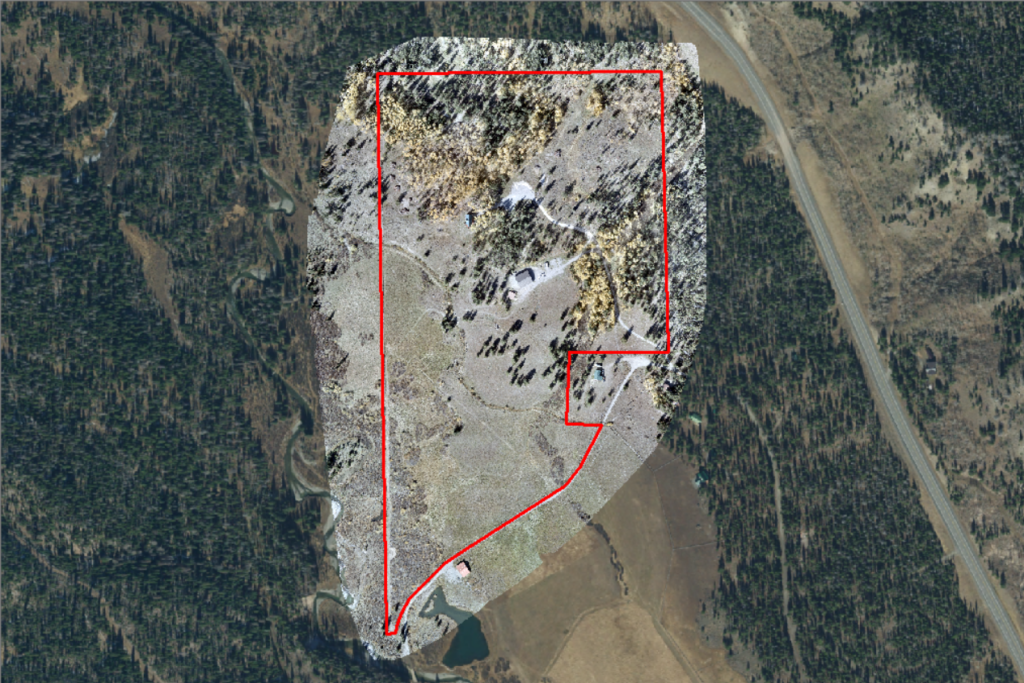
This example was flown in mid-July, immediately after some wildfire mitigation work was completed. If you look NW of the house, you can see slash piles scattered throughout. We used this orthomosiac to not only count the piles, but also analyzed the total volume of hazardous fuel that was removed from the forest.

You can also see that a new structure has been constructed near the bottom of the photo. This could be a good example of before and after on a construction project.

This example was flown in late September. You can see that some of the aspen on the property are starrting to turn bright yellow, but most are still green.

This is a screenshot from the orthomosaic created from an early October flight. Notice how almost all the aspen is now a bright yellow.

In addition to the true color orthomosaics you see here, we can also perform spectral analysis of each of this to show different things. You will see those on the Spectral Analysis page.

Better Detail

Here is the example we talk about to show how much better resolution and details we can get when we make a new orthomosaic. The first photo is what is publicly available for anyone to view. The next one is one we created with an October flight to capture the fall color of the aspen trees.

Preparing to launch for a mapping mission.